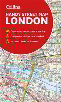
Collins London Handy Street Map
89 kr.
89 kr.
Tidligere laveste pris:
94 kr.
Fre., 13 juni - tors., 19 juni
Sikker betaling
14 dages åbent køb
Sælges og leveres af
AdlibrisProduktbeskrivelse
Clear and easy-to-read map of central London and surrounding area. Contains detailed mapping, presented in a handy compact format.
This attractive map, ideal for both tourists and residents, and fully updated, has an extensive area of coverage and displays a wealth of detail.
This map includes:
• New for this edition: Electric car recharging sites
• Fully classified roads
• Congestion charging zone & T-charge (Ultra Low Emission Zone from April 2019)
• Postal districts and boundaries clearly depicted
• Full indexes to street names (on back of map), place names and places of interest
• Fully updated London underground map conveniently located on the back cover
Covers this area:
Extends from Hampstead in the north to Clapham in the south and from Hammersmith in the west to Greenwich in the east.
Scale: 1:17,500 (3.6 inches to 1 mile)
Varenr.
786422ee-df12-55e6-8db4-e219c0b66380
Collins London Handy Street Map
89 kr.
89 kr.
Tidligere laveste pris:
94 kr.
Fre., 13 juni - tors., 19 juni
Sikker betaling
14 dages åbent køb
Sælges og leveres af
AdlibrisLignende topsælgere

Bright Beauty Vanity Namira - make up spejl med belysning - hollywood spejl - schminke spejl med lys - hvid - dæmpbar med tre lystilstande
539 kr.

POP MART Labubu Monsters Macaron Vinyl Face 17cm Blind Box
123 kr.

POP MART Labubu The Monsters – Exciting Macaron Blind Box 17 cm Vinyl Samlerfigur | Designer Toy | Original produkt
169 kr.

POP MART Labubu The Monsters Big into Energy 17 cm
159 kr.
")
1 stk. POP MART Labubu 3.0 Big into Energy Blind Box Figur – The Monsters Vinyl Plysch Hänge 17 cm (tilfældig farve, enkelt pakke)
169 kr.

Timer til Klasselokalet - 60 minutter
129 kr.
Tidligere laveste pris:
149 kr.
")
1 stk. POP MART Labubu The Monsters Spændende Macaron Plysfigur Legetøjs Blind Box (tilfældig farve, 17 cm, 1 pakke)
159 kr.

Montessori Busy Board til børn 1-4 år, 12-sidet aktivitetslegetøj med Reißverschluss
140 kr.

FENCHILIIN Hollywood makeup spejl med lys forstørrelse 360° drejelig bordplade hvid spejl 30 x 41 cm
359 kr.
")
G4 Halogenpærer / Stiftpærer - Halogen 10W (10-Pack)
69 kr.
Anbefalede produkter

Wii til HDMI Adapter 1080p Full-HD kompatibel til Nintendo
49 kr.
Tidligere laveste pris:
50 kr.

FENCHILIIN hollywood spejl makeup spejl med lys dæmpbar med tre lystilstande bordplade vægbeslag make up spejl med belysning hvid 58 x 46cm
621 kr.

Silikonetape / Plaster til Ar – Behandling af ar
69 kr.

FENCHILIIN Hollywood stort makeup spejl med lamper bordplade vægmonteret hvid spejl med lys
479 kr.

Scart til HDMI konverter 1080P
56 kr.

Ørepuder til Bose QuietComfort - QC35/QC25/QC15/AE2 Hovedtelefoner Svart
69 kr.

94 CM 3 X Plæneklipperknive til Husqvarna RIDER R213 R214 R215 R216 R316 R318 R320 AWD
265 kr.

vidaXL skur til robotplæneklipper 92x97x63 cm galvaniseret stål grå
483 kr.
Tidligere laveste pris:
484 kr.

Akusoli Akupressur Indlægssåler, Størrelse 40-43 - Ortopædiske såler til Smertelindring
149 kr.

FENCHILIIN Stor Hollywood Makeup Spejl med lys USB bordplade vægbeslag hvid 80 x 58 cm
961 kr.